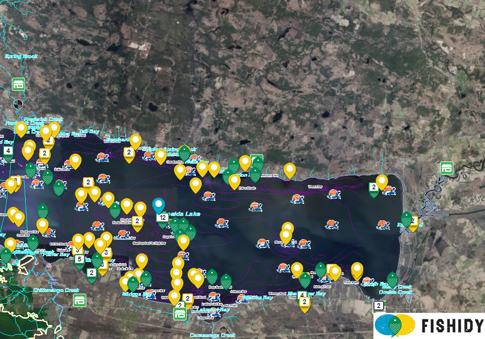
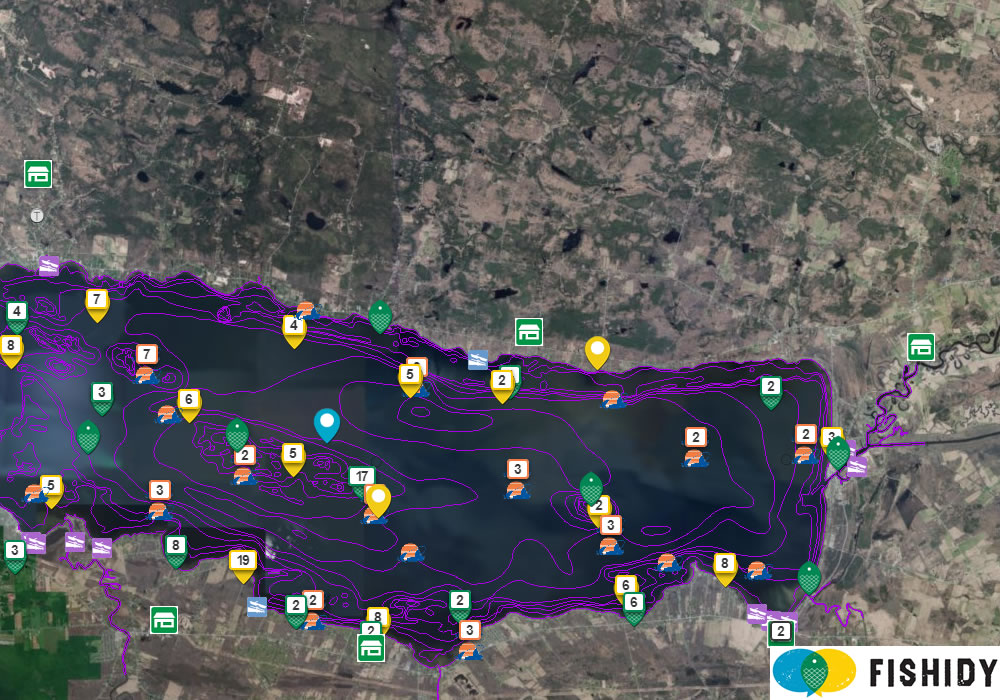
We’ve recently released a new round of improvements to Fishidy’s maps available on both the website and mobile app! The new maps are now much easier to view, with improvements made to the clarity of many of the icons and symbols that designate important fishing areas, structures, and navigational sections.
The Major Enhancements:
- Removed unnecessary/duplicative general map layers
- Improved the contrast of the contour lines layer for increased visibility
- Improved the clustering behavior of user-generated fishing spots/catches
- Newly created, clarified and consolidation of icons/symbols for increased visibility
- Adjustments to zoom levels and when specific layers come into view
- Dynamic waterway info/activity stream sidebar while panning the map
Here are some before and after shots of a few of our popular waterways in Fishidy:
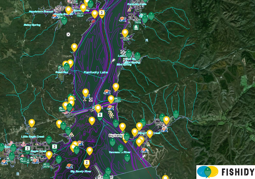
Kentucky Lake Fishing Map – BEFORE
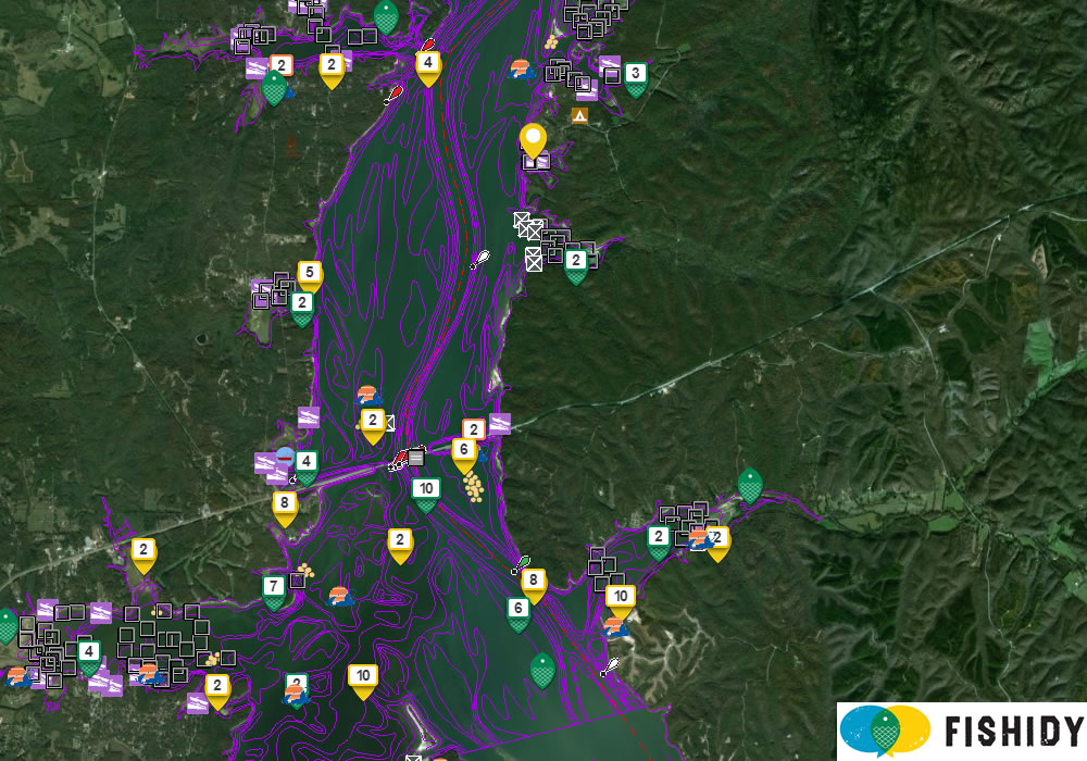
Kentucky Lake Fishing Map – AFTER
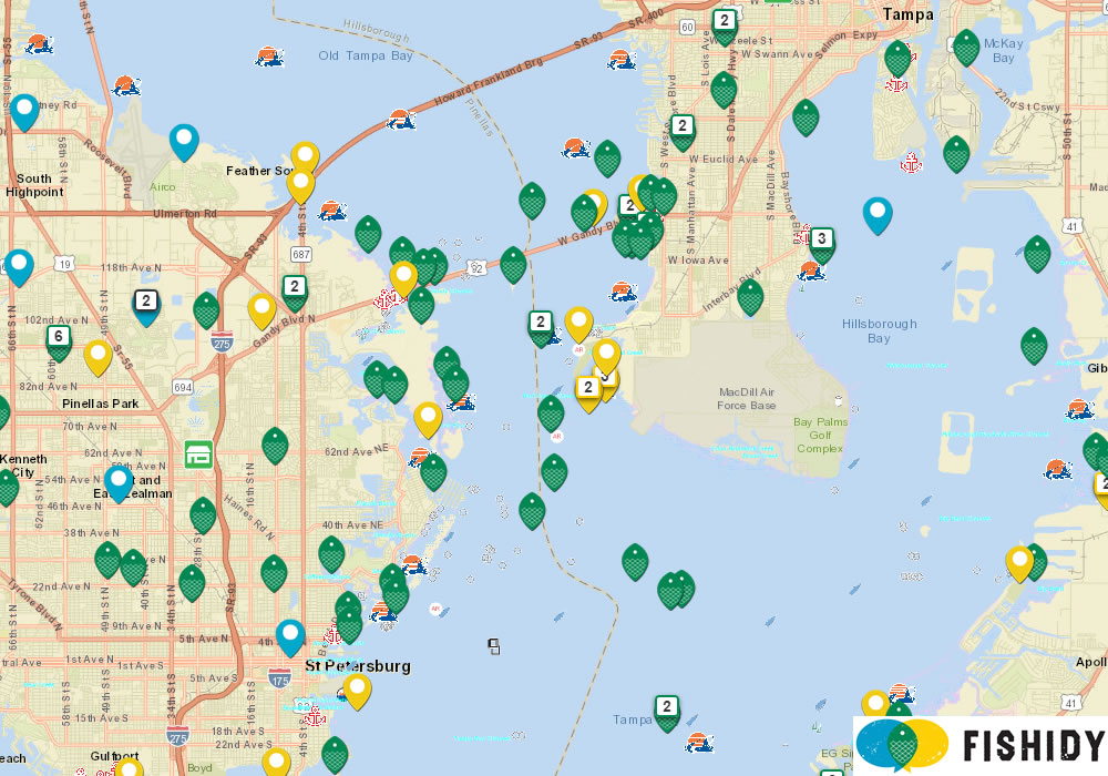
Tampa Bay Fishing Map – BEFORE
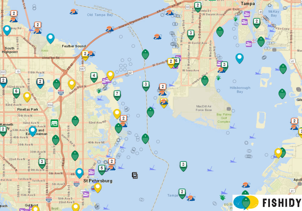
Tampa Bay Fishing Map – AFTER
Oneida Lake Fishing Map – BEFORE
Oneida Lake Fishing Map – AFTER
We hope you enjoy these improvements. Login to your Fishidy account to check things out for yourself!


